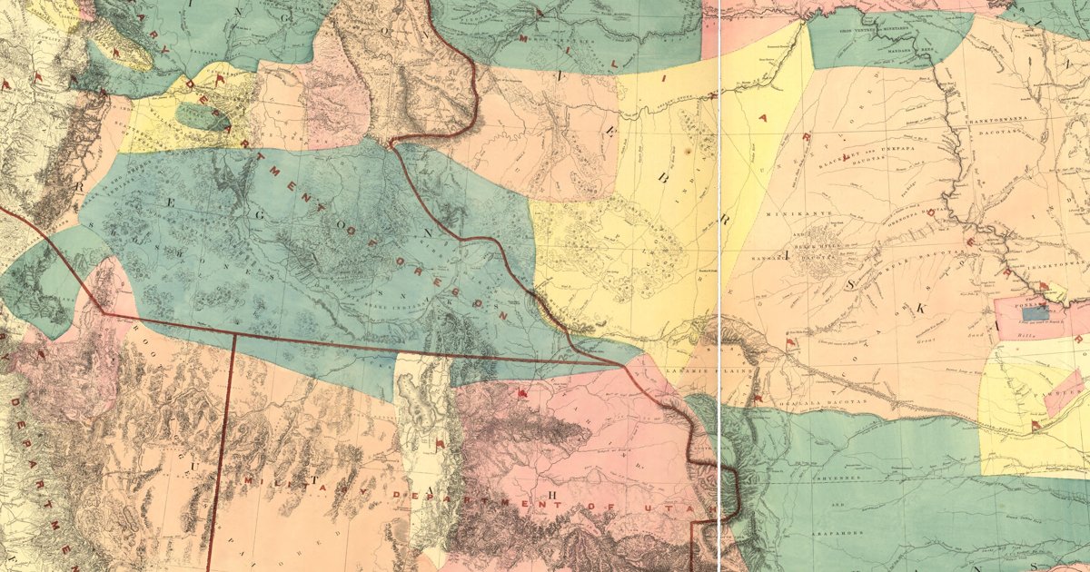
Arkansas: Native trails and villages

The Quapaw, Caddo and Osage countries, from Warren's 1857 map, with the southeastern trail network at the state's eastern edge.

Open full-screen map

Advertisement

Historic maps for Arkansas

Preview of Memphis to the St. Francis, 1833

Memphis to the St. Francis, 1833

W. Howard, U.S. Civil Engineers, 1835 · about 5 km accuracy

The Army engineers’ survey for the Military Road across the Mississippi swamps from opposite Memphis to the St. Francis River in 1833: the Indian Track and the Indian Trail that ran along the higher ground north of the new road, the bayous, lakes and cane brakes, and the landings and settlements of the time.

Source: Library of Congress · Rights: public domain

Open in the map

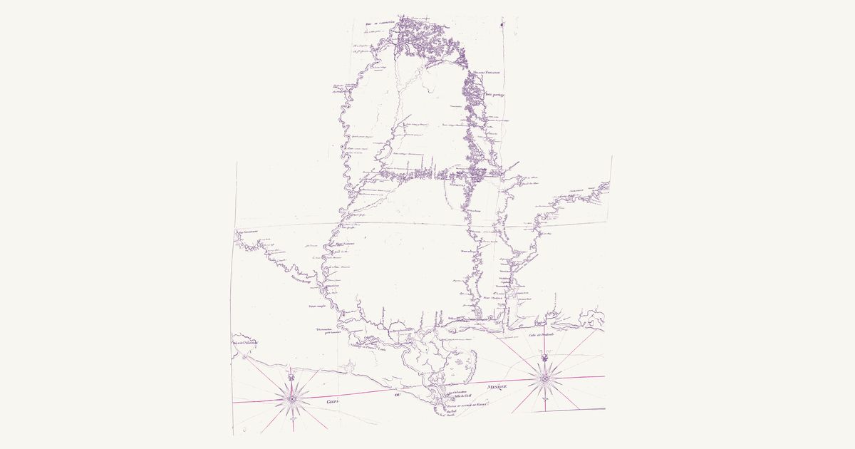
Preview of Broutin’s Louisiana routes, 1743

Broutin’s Louisiana routes, 1743

Broutin, de Vergés and Saucier, 1743 · about 29 km accuracy

A French manuscript map signed at New Orleans on 10 November 1743 by Demarigny, drawn from the surveys of the engineers Ignace-François Broutin and de Vergés and the draughtsman Saucier: the Mississippi from the Balize to Fort de l’Assomption (Memphis), with the Red River, the Yazoo, the Pascagoula, the Mobile and the Tombigbee up to the Chickasaw country, and the overland routes they measured by pace in the years of the French Chickasaw campaigns of 1736–40, drawn as red dotted lines. A key, “Renvoye des routtes par terre”, names each route by its lettered points: from Fort St. Martin (A) on the Mississippi over the heights (B) to the Yazoo; from Fort de l’Assomption to the first branch of the Yazoo (E) and on to the Chickasaw; up the Margot (F–K); from the Petit portage on the Tombigbee (M) to the Chickasaw; and Saucier’s routes from the Chickasaw to the Choctaw, from the Yazoo (L) to the Choctaw towns and Fort Tombecbé, and from that post to the Chickasaw. A Nota describes the ground of each — open oak ridges and prairie, canebrakes, ravines and drowned bottoms. It draws the Villages Tchkachas (Chickasaw), the Choctaw towns inside a dotted “circuit des villages Tchactas au nombre de 44 villages”, the “passage des anglois” — the English traders’ way — from the Choctaw towns to Tombecbé, the Alabama towns at Fort Toulouse, and the villages and old village sites of the Arkansas, Tunica, Avoyel, Chakchiuma, Ibitoupa, Biloxi, Mobile and Tawasa. The title, key and Nota are not shown.

Source: Library of Congress · Rights: public domain

Open in the map

Preview of Gallatin's tribes of North America, 1836

Gallatin's tribes of North America, 1836

Hon. Albert Gallatin; published by the American Antiquarian Society, Pendleton's Lithography, 1836 · about 100 km accuracy

Albert Gallatin's founding map of American ethnology, published by the American Antiquarian Society with his Synopsis of the Indian Tribes: the homelands of the continent's nations tinted by language family — Algonkin-Lenape, Iroquois, Cherokee, Muskogee, Choctaw-Chickasaw, Sioux, Blackfeet, Pawnee, Athapasca, Eskimaux — as of about 1600 along the Atlantic and about 1800 westward. A continental baseline: every state shows its nations here.

Source: Library of Congress, Geography and Map Division · Rights: public domain

Open in the map
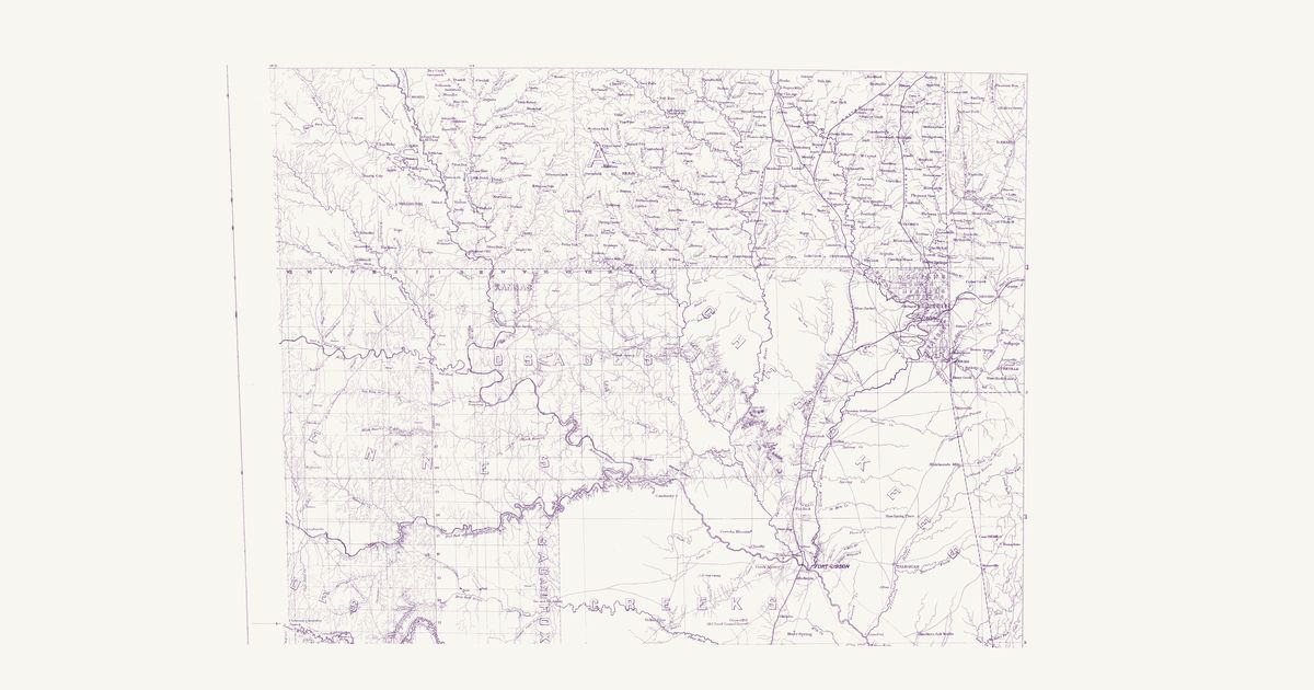
Preview of Indian Territory, northeast, 1875

Indian Territory, northeast, 1875

E. H. Ruffner, U.S. Engineers, 1875 · about 3 km accuracy

The northeast sheet of Lieutenant E. H. Ruffner’s 1875 military map of the Indian Territory: the Cherokee, Creek, Osage and the small nations of the Quapaw agency, with the Indian trails, wagon roads and settlements from the Kansas line to the Arkansas.

Source: New York Public Library · Rights: public domain

Open in the map

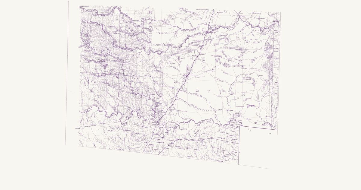
Preview of Indian Territory, southeast, 1875

Indian Territory, southeast, 1875

E. H. Ruffner, U.S. Engineers, 1875 · about 5 km accuracy

The southeast sheet of Lieutenant E. H. Ruffner’s 1875 military map of the Indian Territory: the Choctaw and Chickasaw nations from the Canadian to the Red River, with the Indian trails, wagon roads, settlements and missions.

Source: New York Public Library · Rights: public domain

Open in the map
Preview of Warren's map of the West, 1857

Warren's map of the West, 1857

Lieut. G. K. Warren, Topographical Engineers, U.S. War Department, 1857 · about 50 km accuracy

Lieutenant G. K. Warren's master map of the West, compiled in the Office of Pacific Railroad Surveys from every reliable exploration to date: the named country of each nation — Dacotas, Sheyennes, Comanches, Shoshonees, Utahs, Navajoes, Apaches, Blackfeet, Crows, Nez Perces, Pawnees and many more — with villages, forts, and the explorers' and emigrant routes that followed Native trails.

Source: Library of Congress, Geography and Map Division · Rights: public domain

Open in the map
What the 1857 map shows

Lieutenant G. K. Warren compiled the War Department’s master map of the West from every exploration to date. Each nation’s country is named and tinted, with villages, forts, and the exploration and emigrant routes — most of them following trails travelled for centuries. Use the scan layer: the color tints carry the meaning.

Reading the overlay

At 1:3,000,000 the territory boundaries are Warren’s synthesis, not surveyed lines — read them as whose country, accurate to a few tens of kilometres.

Talk about Arkansas

Discussion board for AR

Start a thread All discussions

Know Arkansas? Join free to add field notes, fix where a place sits on the map, and help find more maps.Join free

Sources from readers

Know a county history, a survey record or an article that bears on this? Add a source — it’s credited to you.

Advertisement