New York: Native trails and villages
Morgan & Parker's 1851 map of the Haudenosaunee homeland, redrawn in 1962, laid over today's roads: the Central Trail from the Mohawk to the Genesee, the lake shores, and the villages of the Six Nations.
Open full-screen map
Historic maps for New York
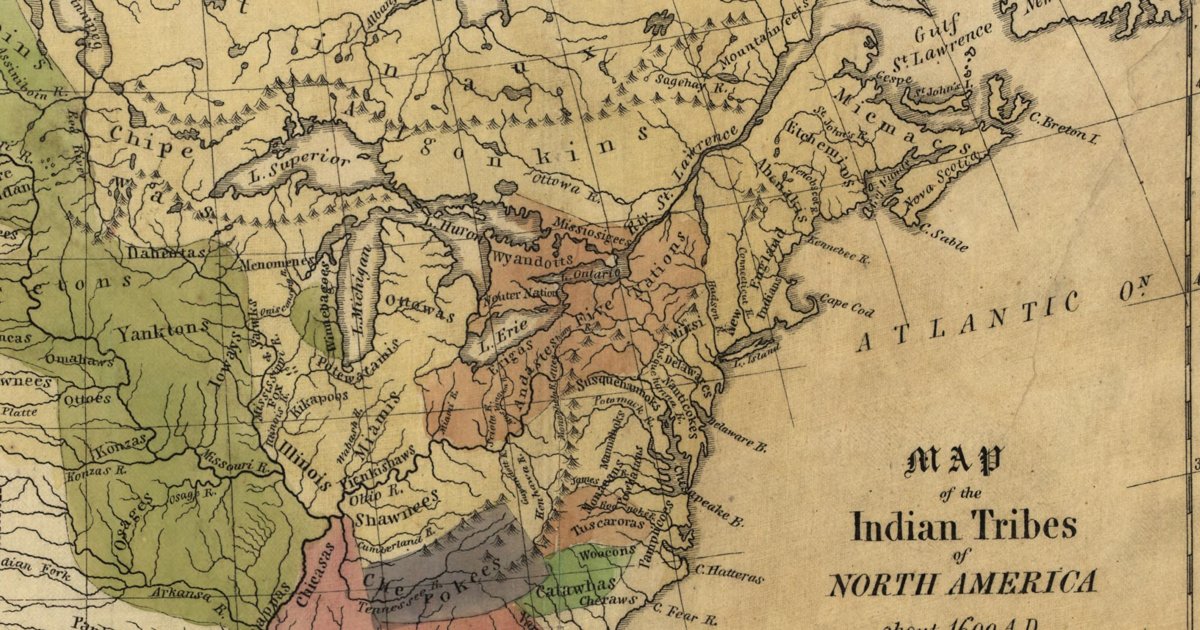
Hon. Albert Gallatin; published by the American Antiquarian Society, Pendleton's Lithography, 1836 · about 100 km accuracy
Albert Gallatin's founding map of American ethnology, published by the American Antiquarian Society with his Synopsis of the Indian Tribes: the homelands of the continent's nations tinted by language family — Algonkin-Lenape, Iroquois, Cherokee, Muskogee, Choctaw-Chickasaw, Sioux, Blackfeet, Pawnee, Athapasca, Eskimaux — as of about 1600 along the Atlantic and about 1800 westward. A continental baseline: every state shows its nations here.
Source: Library of Congress, Geography and Map Division · Rights: public domain
Open in the map
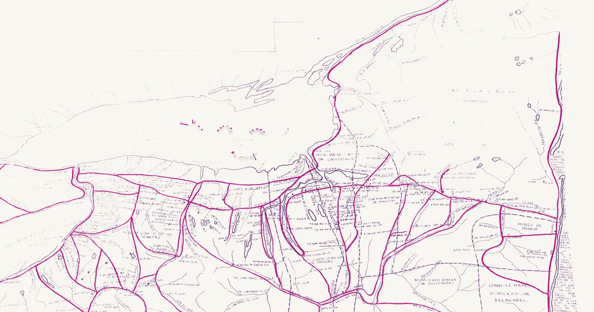
Lewis H. Morgan and Ely S. Parker, 1851 · redrawn 1962 · about 5 km accuracy
Lewis Henry Morgan and Ely S. Parker's 1851 map of the Haudenosaunee homeland, showing the principal trails, villages, lakes and rivers with their Iroquois names, in Eber L. Russell's 1962 redraw with villages, trails and springs added from fifty years of research. Rubber-sheeted to modern lakes and river junctions.
Source: Norman B. Leventhal Map & Education Center, Boston Public Library · Rights: public domain
Open in the map
What the 1851 map shows
Lewis Henry Morgan and Ely S. Parker, a Seneca, compiled the map for Morgan’s League of the Iroquois (1851) from French maps of 1720 and earlier and from Parker’s knowledge. It draws the principal trails as dotted lines, the villages, and the lakes and rivers with their Haudenosaunee names. Eber L. Russell of Perrysburg redrew it in 1962 at twice the scale, adding villages, trails and springs from fifty years of his own research.
The spine of the network is the Central Trail (the “Iroquois Trail”), which ran from the Hudson at Albany up the Mohawk to the carrying place at Rome, then west through Oneida Castle, Canastota, Chittenango and Onondaga to Cayuga, Geneva, Canandaigua and the Genesee. Its line survives as NY-5, the Seneca Turnpike and, at a distance, the Thruway. Branches ran north to Oneida Lake and Oswego, south down the Chenango and Susquehanna, and west along the lake shores.
Reading the overlay
The 1962 drawing is loose. Its scale wanders across the sheet and some village symbols sit 10–15 km from the historic sites, so the overlay is rubber-sheeted to lakes and river junctions and is accurate to about 5 km. Use the slider to fade between the sheet and today’s map, switch to the original scan to read Russell’s lettering, and search a historic name to jump to it.
By county
- Cayuga County — Auburn on the Owasco outlet, the Cayuga villages along the lake, and the crossing of the Cayuga outlet on the Central Trail.
- Herkimer County — The Mohawk at Herkimer and Little Falls; West Canada Creek; the valley trail on both banks.
- Madison County — Oneida Castle, Canastota, Chittenango and Cazenovia on the Central Trail; the Oneida heartland.
- Montgomery County — The Schoharie mouth at Fort Hunter, the Mohawk castles, Canajoharie and Amsterdam on the valley trail.
- Oneida County — Rome, the carrying place between the Mohawk and Wood Creek; Utica; the trail from Oneida Castle to the Mohawk.
- Onondaga County — Onondaga, the central council fire of the Confederacy; Onondaga Lake; the Central Trail and the branch north to Three Rivers.
- Ontario County — Kanadesaga (Geneva), the Seneca capital of the 1700s, and Canandaigua on the Central Trail west of the lakes.
- Seneca County — Between the lakes: Seneca Falls, Waterloo (Skoiyase) and the Montezuma marsh, where the Central Trail crossed.
Trails
- The Central Trail: Onondaga to Canandaigua — The western half of the Iroquois Trail across the Finger Lakes: Marcellus, Skaneateles, Auburn, the Cayuga crossing, Seneca Falls, Geneva and Canandaigua.
- The Genesee valley — The trail down the Genesee from the falls at Rochester through Avon, Geneseo and Mount Morris to Nunda, Caneadea and the Allegheny.
- The Mohawk valley — The trail from the carrying place at Rome down the Mohawk to Utica, Herkimer, Little Falls, Canajoharie, Fort Hunter, Schenectady and the Hudson at Cohoes.
- Oneida Lake and the Oswego River — The branch from the Central Trail north to Oneida Lake, Three Rivers and Oswego, and the shore trail along Lake Ontario to the Salmon River.
- The Central Trail: Onondaga to Rome — The eastern half of the Iroquois Trail, from the Onondaga council fire through Manlius, Chittenango, Canastota and Oneida Castle to the carrying place at Rome.
- Susquehanna and Chenango — The trails south from Oneida country down the Chenango to Binghamton, and from Otsego Lake down the Susquehanna to Sidney and the Great Bend.