Delaware: Native trails and villages

The Lenape and Nanticoke homelands on Gallatin's 1836 map of the tribes.

Open full-screen map

Advertisement

Historic maps for Delaware

Preview of Gallatin's tribes of North America, 1836

Gallatin's tribes of North America, 1836

Hon. Albert Gallatin; published by the American Antiquarian Society, Pendleton's Lithography, 1836 · about 100 km accuracy

Albert Gallatin's founding map of American ethnology, published by the American Antiquarian Society with his Synopsis of the Indian Tribes: the homelands of the continent's nations tinted by language family — Algonkin-Lenape, Iroquois, Cherokee, Muskogee, Choctaw-Chickasaw, Sioux, Blackfeet, Pawnee, Athapasca, Eskimaux — as of about 1600 along the Atlantic and about 1800 westward. A continental baseline: every state shows its nations here.

Source: Library of Congress, Geography and Map Division · Rights: public domain

Open in the map

Preview of Pennsylvania, 1792 (Howell)

Pennsylvania, 1792 (Howell)

Reading Howell, 1792 · about 5 km accuracy

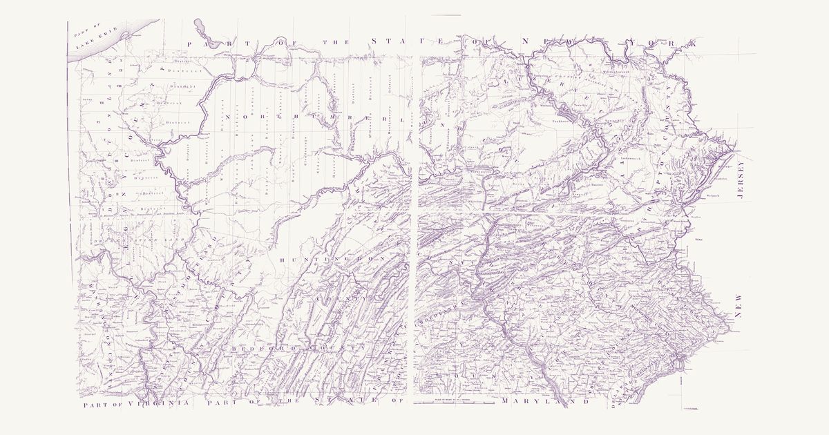
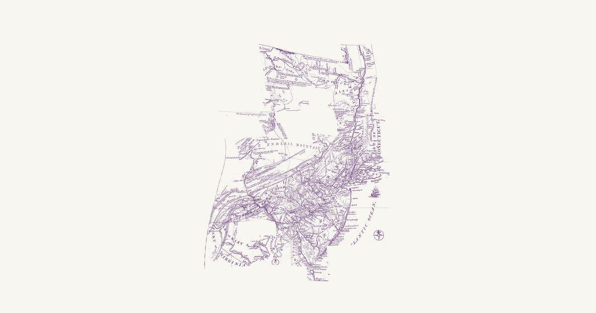
Reading Howell’s map of the state, published at Philadelphia in 1792 and shown here in the facsimile printed for the Pennsylvania Archives in 1896: Pennsylvania from Lake Erie and the Ohio line to the Delaware, with its counties and townships, the Depreciation and Donation lands of the northwest, the district lines of the late surveys, the roads, mills, forges and towns of the new state, and the edges of New York, New Jersey, Delaware, Maryland, Ohio and Virginia. Howell compiled it from the Land Office surveys and the state’s own surveys of its boundaries and rivers. Its Explanation keys “An Indian Path” (a fine dotted line) and “An Indian town” (a small tent): Kuskusky, a Moravian town on the Beaver, Logs Town, Conemaugh, Frankstown and Obeals (Cornplanter’s town) on the Allegheny, and paths of the Lenape (Delaware), Shawnee, Seneca and other Haudenosaunee nations across the north and west — the Snow Shoe path from the West Branch to the Bald Eagle’s Nest, the “Portage 23 Miles” between the Canoe Places of the Allegheny and the Sinnemahoning, the Kittanning path toward Frankstown, the Sheshequin path over Burnet’s Hills, and shorter paths to the Lick on the Elk Lick Branch and to the Salt Spring. Not shown: the copyright notice, the title, the dedication, the Explanation, the mounting strip and cloth seam between the four pieces of the sheet, and the margins.

Source: Library of Congress · Rights: public domain

Open in the map

Preview of Improved part of Pennsylvania, 1759

Improved part of Pennsylvania, 1759

Nicholas Scull, 1759 · about 15 km accuracy

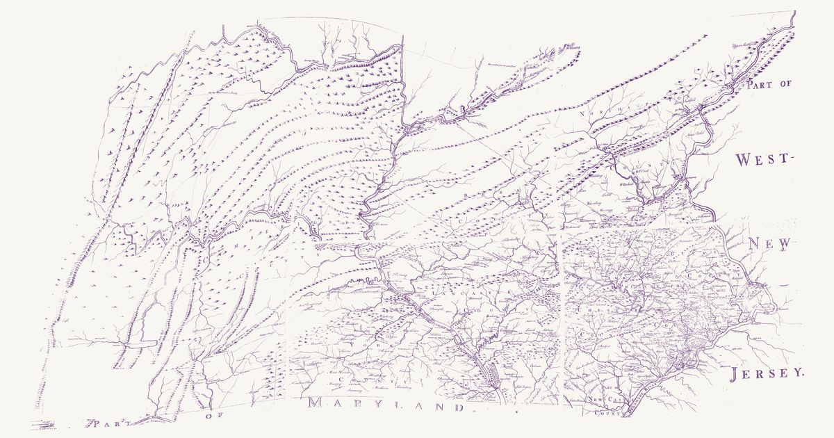
Nicholas Scull’s map of the settled part of Pennsylvania, engraved by James Turner and printed by John Davis, sold by the author in Philadelphia in 1759: the counties of Philadelphia, Bucks, Chester, Lancaster, York, Cumberland, Berks and Northampton and the north end of New Castle County, laid out in their townships with roads, ferries, mills, iron works, churches and meeting houses and the forts of the late war, from the Delaware and West Jersey to the Allegheny Mountains, and beyond the Kittatinny Mountains the frontier up the Juniata and the West and North-East Branches of the Susquehanna — the two branches from Fort Augusta (Shamokin) up to Wioming laid down, its notes say, from Major Shippen’s draughts. That frontier was still the country of the Lenape (Delaware), Shawnee and Haudenosaunee and of the Susquehannock before them, and the map marks their towns: Wioming, Nescopeck, Lanpaughpeton’s town and Old King Neutimus’s on the North-East Branch, Chillisquaquy, French Margaret’s, Quinishahaquy and Tiquamingy Town on the West Branch, Chingleclamouche, Bald-Eagle’s Nest, Frank’s Town and the Shawane Cabbins. Its key reads “The prick’d Lines are Indian Paths”, and it draws them: the “Warriors Path from the great Island” by the West Branch and across the hills to the North-East Branch below Wyoming; the “Path to Wyoming” up the North-East Branch from Fort Augusta; the “Path from Chingleclamouche to Shamokin” over the plateau to the Great Island, and on down the West Branch to Shamokin; a “Warriors Path” by Licking Creek over the North-East Branch toward the Catawissa; the “Ohio Path” west from Frank’s Town over the Allegheny Mountain; the paths up Bald Eagle Creek, from Bald-Eagle’s Nest and Frank’s Town to the Standing Stone, and on to Fort Shirley; and a “Warriors Path” south from Allequippy’s Gap toward Maryland. Not shown: the title cartouche, the key, the notes and the scale, and the cloth seams between the six sheets.

Source: Library of Congress · Rights: public domain

Open in the map

Preview of Pennsylvania and New York, 1749

Pennsylvania and New York, 1749

Lewis Evans, 1752 · about 21 km accuracy

Lewis Evans’s map of Pennsylvania, New Jersey, New York and the three Delaware counties, first published at Philadelphia in 1749 — this is the second edition of July 1752. North and west of the settlements it letters the Six Nations’ country across the upper Susquehanna and the lands of the Mohawk, Oneida, Onondaga and Tuscarora along the Mohawk River and Wood Creek, with “Onondaga where the Gen.l Council of the Confederate Republic of the Six Nations meets”, and it marks the Indian towns of the Susquehanna and Juniata country, home then to Lenape, Shawnee and Haudenosaunee people — Shamokin, Wyoming, Owego, Osewingo, French Margaret’s town and Black Log. Its paths there are dotted and named: the “Path to Wióming”, “A Path to Shamokin scarce passable for 3 steep Mountains”, “The new Path” and the “Tuscarora Path” from Black Log, with the carrying places from the Mohawk to Wood Creek and from the Hudson to Wood Creek. Another dotted line is the route Evans rode with John Bartram and Conrad Weiser to Onondaga and Oswego in 1743, and a third the bound of the lands the Six Nations released at Philadelphia on 22 August 1749, from the Kittatinny Mountains north to that line. The long notes on the weather, the mountains and the longitude, the key and the table of distances are not shown.

Source: Library of Congress · Rights: public domain

Open in the map
Preview of Middle British Colonies, 1755

Middle British Colonies, 1755

Lewis Evans, 1755 · about 61 km accuracy

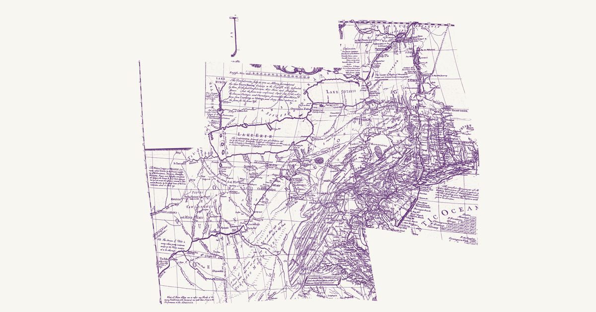
Lewis Evans’s 1755 map of the middle colonies and the Six Nations’ country: the Indian towns of the Ohio and the Susquehanna, the war paths and trading paths with their mileages, the portages, and his notes on the land, from Lake Ontario to the Kentucky country.

Source: Library of Congress · Rights: public domain

Open in the map
Preview of Virginia and Maryland, 1755

Virginia and Maryland, 1755

Joshua Fry and Peter Jefferson, 1755 · about 28 km accuracy

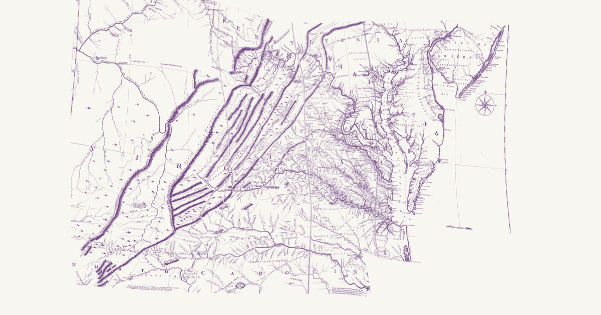
Joshua Fry and Peter Jefferson’s map of Virginia, in the 1755 Jefferys edition: the Indian Road by the Treaty of Lancaster down the Great Valley, the Indian road over the Alleghenies to the forks of the Ohio, and the Shawnee and Delaware towns of the upper Ohio.

Source: Library of Congress · Rights: public domain

Open in the map
What the 1836 map shows

Albert Gallatin’s map — the founding map of American ethnology — tints each language family’s homelands: the Atlantic states as of about 1600, the west as of about 1800. It is the continental baseline; a dedicated state map replaces it as each state’s overlay is built.

Reading the overlay

At 1:18,000,000 read the tints as regions, not lines. The scan layer carries the color key.

Talk about Delaware

Discussion board for DE

Start a thread All discussions

Know Delaware? Join free to add field notes, fix where a place sits on the map, and help find more maps.Join free

Sources from readers

Know a county history, a survey record or an article that bears on this? Add a source — it’s credited to you.

Advertisement