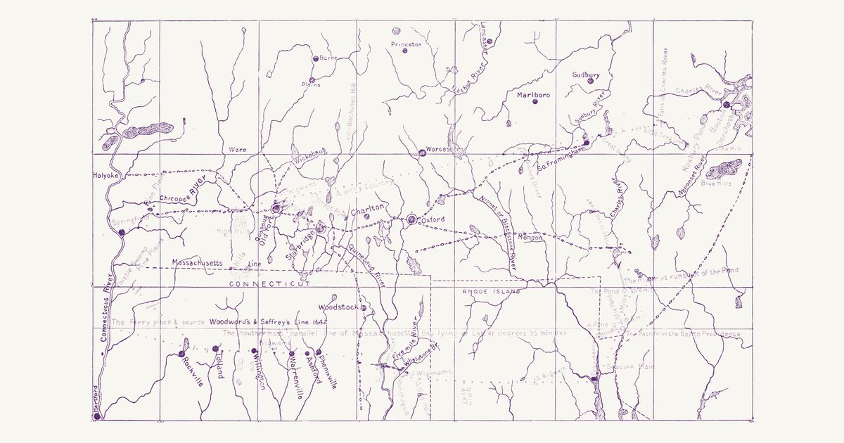
Levi Badger Chase’s map for his 1901 article on Woodward and Saffery’s 1642 survey of the Massachusetts Bay patent’s south line, drawn on a USGS base: the paths of Nipmuc country as he traced them — the Bay Path from South Framingham through Oxford and Sturbridge to Quabaug Old Fort and Springfield, branches to the Great Falls at Holyoke, the Ware River falls and Wickabaug, the path south to Woodstock (Wabaquasset), the Path to Nipmug Great Pond through Mendon — and the path from the Bay to Providence. In red, the 1642 map’s route and notes.
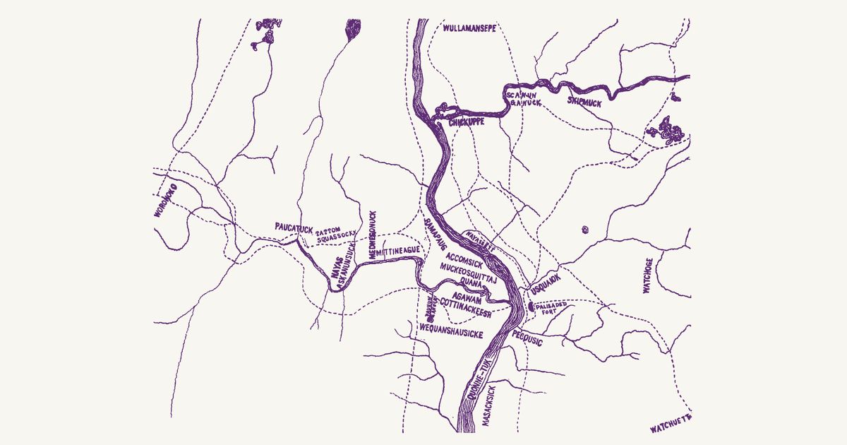
Harry Andrew Wright’s map of the Indian trails about Springfield, sheet 1 of his Early Maps of the Connecticut Valley in Massachusetts (1911): the paths of the Agawam people at Springfield and the Woronoco at Westfield, where the Chicopee and the Agawam (Westfield) meet the Connecticut (Quonne-tuk), traced from early deeds and records — the Bay Path from the east to the Palisaded Fort and over the river toward Woronoko, the path south to Windsor, Pynchon’s “Pequit path that goes to Moheag” — with the Native names of meadows, falls and brooks.
Hon. Albert Gallatin; published by the American Antiquarian Society, Pendleton's Lithography, 1836 · about 100 km accuracy
Albert Gallatin's founding map of American ethnology, published by the American Antiquarian Society with his Synopsis of the Indian Tribes: the homelands of the continent's nations tinted by language family — Algonkin-Lenape, Iroquois, Cherokee, Muskogee, Choctaw-Chickasaw, Sioux, Blackfeet, Pawnee, Athapasca, Eskimaux — as of about 1600 along the Atlantic and about 1800 westward. A continental baseline: every state shows its nations here.
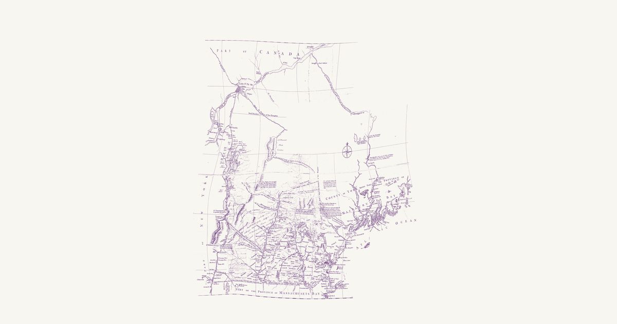
Joseph Blanchard and Samuel Langdon, 1761 · about 20 km accuracy
Joseph Blanchard and Samuel Langdon’s map of New Hampshire, dedicated at Portsmouth in October 1761 and engraved in London by Thomas Jefferys: the province and the country around it in the last French war, from Albany and Lake Champlain to Penobscot Bay and north to Quebec and the St. Lawrence. Its notes record the Wabanaki (Abenaki) ways north to Canada as the colonists of the wars knew them: the “Indian carrying Place from Kennebeck into the River Chaudiere”, drawn as a double-pricked line through three ponds; the Chaudière, “drawn agreable to the Accounts which the Indians give of their Travelling to Canada this way”; the river and lakes by which “Lieut. Starks was led Captive by the Indians from Connecticut River to Canada 1752”; and the ways captives were taken up the Black River, and up Wells River and down the French River toward Lake Champlain. It marks St. Francis (Odanak) by Lake St. Peter, notes Norridgewock on the Kennebec as the seat of a Wabanaki people, and records what “is said by the Indians” of a short carrying place between the heads of the Connecticut and the Androscoggin. This copy carries contemporary ink additions — the New Hampshire Grants townships west of the Connecticut and some northern rivers — left as they are; the upper Chaudière, drawn from report too freely to place, is not shown.
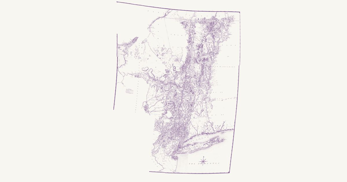
Claude Joseph Sauthier, 1779 · about 29 km accuracy
Claude Joseph Sauthier’s great survey map of New York on the eve of the Revolution: the patents and townships, the Oneida, Onondaga and Mohawk country with its castles and carrying places, and the paths from the Mohawk to Oswego and the St. Lawrence.
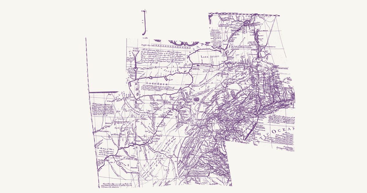
Lewis Evans’s 1755 map of the middle colonies and the Six Nations’ country: the Indian towns of the Ohio and the Susquehanna, the war paths and trading paths with their mileages, the portages, and his notes on the land, from Lake Ontario to the Kentucky country.
Albert Gallatin’s map — the founding map of American ethnology — tints each language family’s homelands: the Atlantic states as of about 1600, the west as of about 1800. It is the continental baseline; a dedicated state map replaces it as each state’s overlay is built.
Reading the overlay
At 1:18,000,000 read the tints as regions, not lines. The scan layer carries the color key.
Know Massachusetts? Join free to add field notes, fix where a place sits on the map, and help find more maps.Join free
Sources from readers
Know a county history, a survey record or an article that bears on this? Add a source — it’s credited to you.
Advertisement
Your privacy choices. Ads keep this site free; Google serves them. You can turn off personalized ads: you'll still see ads, but not ones chosen from your activity on other sites. In the EU, UK and Switzerland, Google's own consent message asks you instead. Analytics never use cookies or identify you.