Oklahoma: Native trails and villages
The 1894 General Land Office map of the Indian and Oklahoma Territories: the Cherokee, Choctaw, Chickasaw, Muscogee and Seminole Nations with their districts and capitals, the western agencies, and the trails and roads between them.
Open full-screen map
Historic maps for Oklahoma
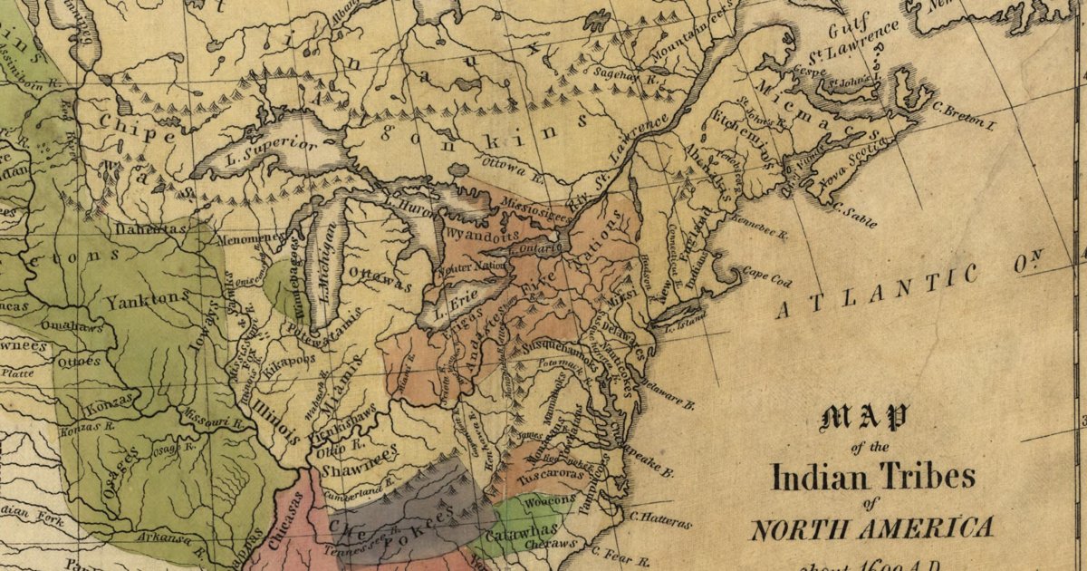
Hon. Albert Gallatin; published by the American Antiquarian Society, Pendleton's Lithography, 1836 · about 100 km accuracy
Albert Gallatin's founding map of American ethnology, published by the American Antiquarian Society with his Synopsis of the Indian Tribes: the homelands of the continent's nations tinted by language family — Algonkin-Lenape, Iroquois, Cherokee, Muskogee, Choctaw-Chickasaw, Sioux, Blackfeet, Pawnee, Athapasca, Eskimaux — as of about 1600 along the Atlantic and about 1800 westward. A continental baseline: every state shows its nations here.
Source: Library of Congress, Geography and Map Division · Rights: public domain
Open in the map
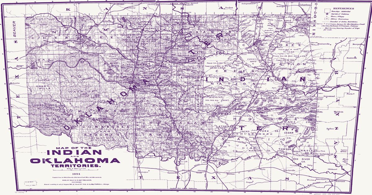
Rand McNally & Co., from General Land Office records, 1894 · about 10 km accuracy
The 1894 Rand McNally map of the Indian and Oklahoma Territories, compiled from the official records of the General Land Office: the Cherokee, Choctaw, Chickasaw, Muscogee (Creek), Seminole and Osage Nations with their districts and capitals, the agencies and military reservations of the western tribes, treaty citations, trails, wagon roads and mail routes on the eve of allotment.
Source: Library of Congress, Geography and Map Division · Rights: public domain
Open in the map
What the 1894 map shows
Compiled from General Land Office records on the eve of allotment, the sheet names the Five Nations’ districts and capitals — Tahlequah, Tuskahoma, Tishomingo, Okmulgee, Wewoka — the Osage, and the agencies and military roads of the west: Fort Sill, Fort Reno, Fort Supply, and the trails between them. Treaty citations are engraved directly on the nations they describe.
Reading the overlay
Boundaries follow the GLO surveys and land well against the modern map; trails and mail routes are schematic. Use the scan layer to read the nation color tints and the treaty notes.