Oregon: Native trails and villages

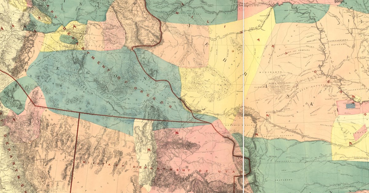
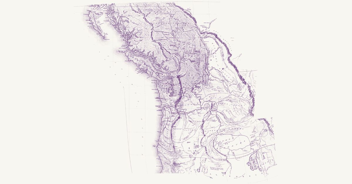
The Chinookan, Kalapuya, Klamath and Shoshone countries of Oregon, from Warren's 1857 War Department map of the West.

Open full-screen map

Advertisement

Historic maps for Oregon

Preview of Gallatin's tribes of North America, 1836

Gallatin's tribes of North America, 1836

Hon. Albert Gallatin; published by the American Antiquarian Society, Pendleton's Lithography, 1836 · about 100 km accuracy

Albert Gallatin's founding map of American ethnology, published by the American Antiquarian Society with his Synopsis of the Indian Tribes: the homelands of the continent's nations tinted by language family — Algonkin-Lenape, Iroquois, Cherokee, Muskogee, Choctaw-Chickasaw, Sioux, Blackfeet, Pawnee, Athapasca, Eskimaux — as of about 1600 along the Atlantic and about 1800 westward. A continental baseline: every state shows its nations here.

Source: Library of Congress, Geography and Map Division · Rights: public domain
Open in the map

Preview of Klamath and Modoc country, 1862

Klamath and Modoc country, 1862

1st Oregon Cavalry, 1862 · about 23 km accuracy

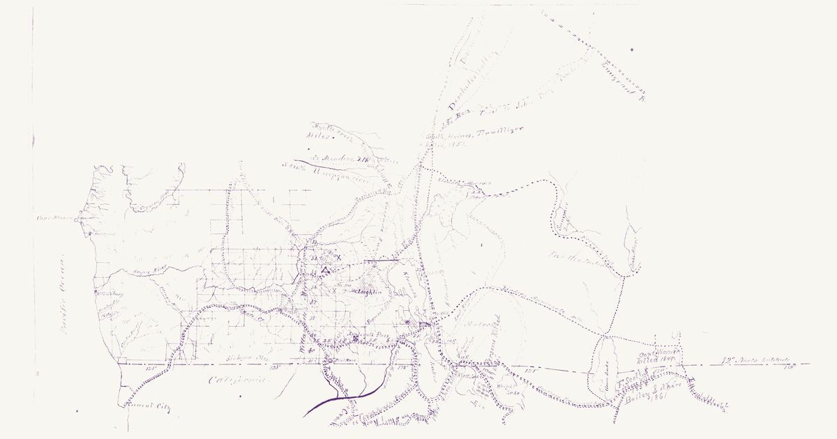
A manuscript field map of south-western Oregon from the 1st Oregon Cavalry’s scout of the Klamath country in 1862: the Rogue valley, the Cascades and the Klamath Lakes east to Goose, Summer and Abert lakes, with Capt. Kelly’s and Lt. White’s camps of September–November 1862, the proposed site for a post at the Klamath Lakes, a proposed agency and reservation for the Klamath and Modoc, and the wagon roads and pack trails explored to the Dalles and Lassen’s Meadows. Its legend keys “Indian Trails in present use” in red: trails of the Klamath (Maqlaqs) and Modoc country — between the villages at Klamath Marsh, on the east shore of Upper Klamath Lake and at Link River, and on to Lost River and Tule (Rhett) and Clear (Wright) lakes — with others west over the Cascades toward the Rogue and Umpqua valleys and north up the Deschutes; the Northern Paiute (“Pah Ute”) country lies to the east. Red notes record killings along the emigrant roads from 1847 to the early 1860s. Lake Harney and the Owyhee country, sketched too freely to place, are not shown; nor are the table of distances and the legend.

Source: Wikimedia Commons · Rights: public domain

Open in the map

Preview of Williamson & Abbot’s Oregon routes, 1855

Williamson & Abbot’s Oregon routes, 1855

Lieut. R. S. Williamson and Lieut. H. L. Abbot, U.S. Topographical Engineers; drawn by John Young, 1859 · about 18 km accuracy

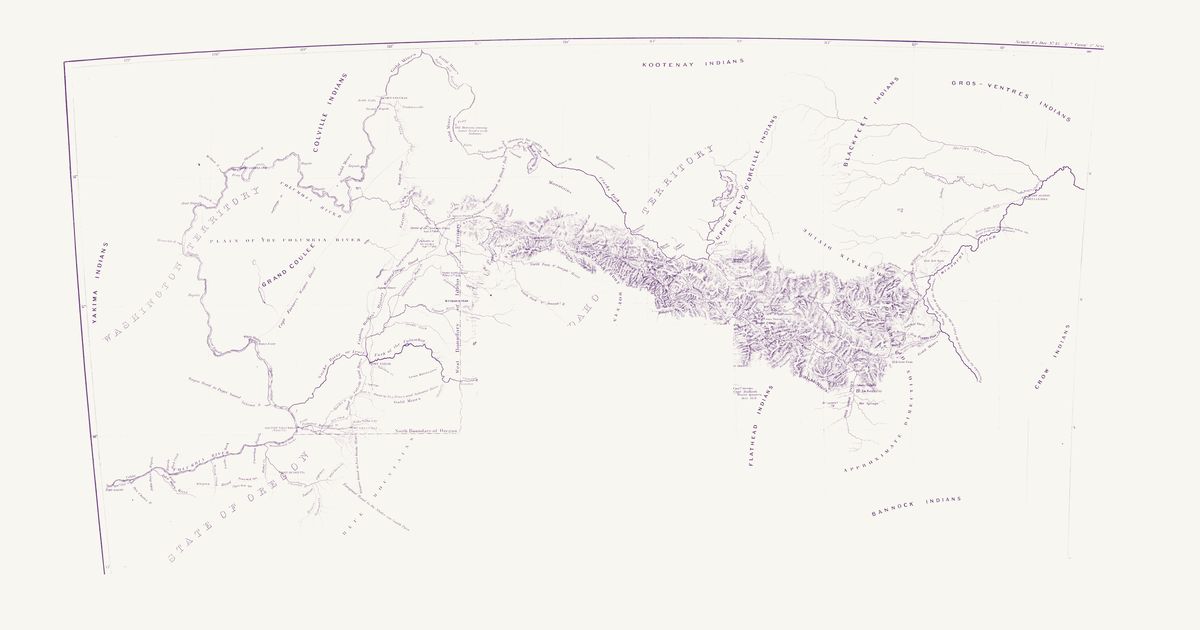
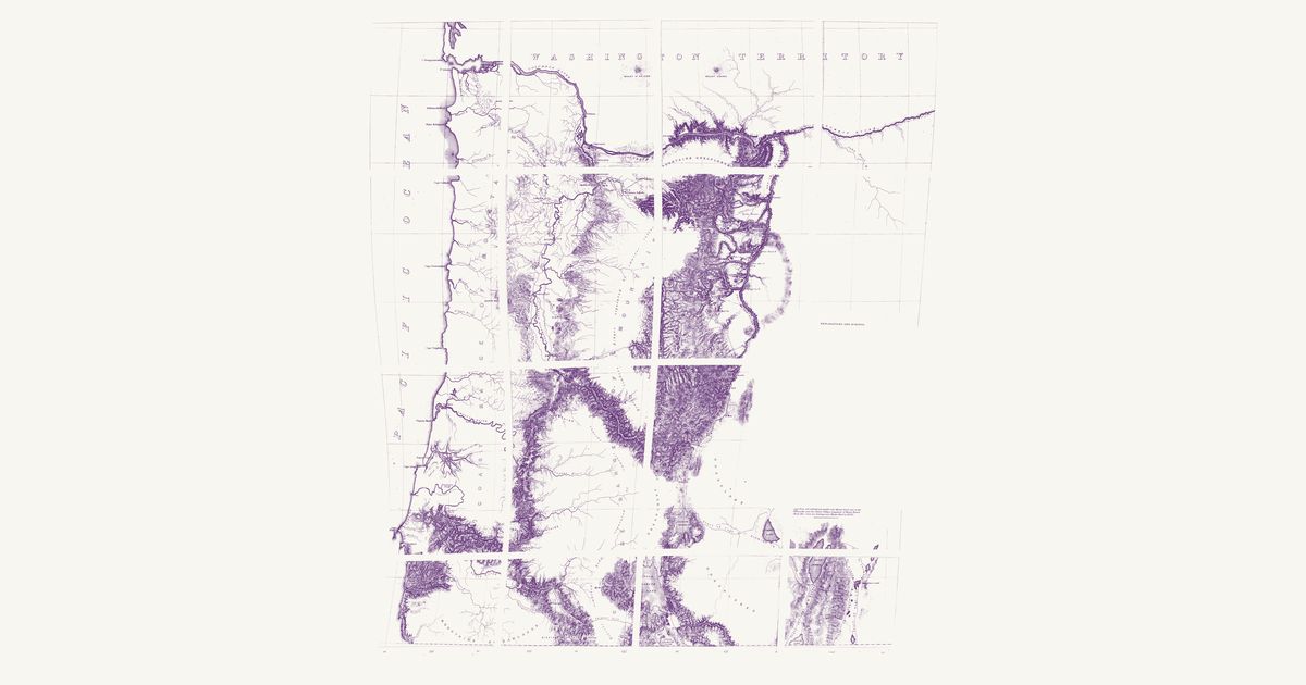
Map No. 2 of the Pacific Railroad Surveys: the routes Lieutenants Robert S. Williamson and Henry L. Abbot explored in 1855 from the northern boundary of California to the Columbia, along the Willamette valley and east of the Cascades by the Deschutes. East of Mount Hood it marks an “Indian Trail” across Tygh (“Tysch”) Prairie, on the way south from the Columbia at the Dalles, and it carries Native names along the way — Wil-la-wit Spring, Nu-ah-hum Peak — with the Klamath lakes and the Rogue, Umpqua and Coquille valleys.

Source: Library of Congress · Rights: public domain

Open in the map

Preview of Mullan Road, 1863

Mullan Road, 1863

John Mullan, U.S. Army, 1863 · about 9 km accuracy

Captain John Mullan’s map of the military road across the northern Rockies and the country around it: the trails of the Nez Perce, Coeur d’Alene, Flathead, Pend d’Oreille, Blackfeet and other nations, the Hudson’s Bay and mission posts, and the 1858 battlefields.

Source: Leventhal Map & Education Center · Rights: public domain

Open in the map

Preview of Nez Perce campaign map, 1877

Nez Perce campaign map, 1877

Robert H. Fletcher (Department of the Columbia), 1877 · about 37 km accuracy

The Department of the Columbia’s map of the 1877 Nez Perce campaign, compiled by Lt. Robert H. Fletcher for Gen. O. O. Howard and printed with the Secretary of War’s report: the Lolo Trail — the Nimiipuu (Nez Perce) road to the buffalo country — from the Weippe and Kamiah country over the Bitterroots by the Lolo Hot Springs and down Lolo Creek to the Bitterroot valley and the Elk City trail. Only the Idaho–Montana part of the sheet is shown.

Source: Wikimedia Commons · Rights: public domain

Open in the map

Preview of Washington Territory nations, 1857

Washington Territory nations, 1857

Isaac I. Stevens and W. H. Carlton, 1857 · about 41 km accuracy

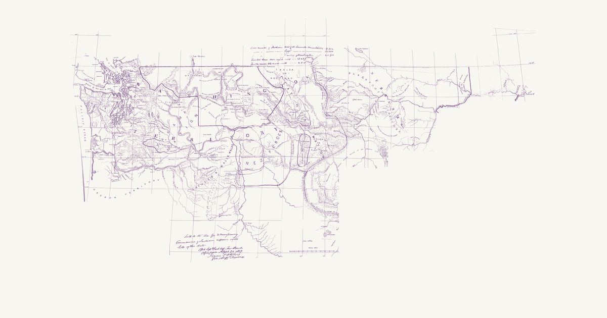
Isaac I. Stevens’s manuscript map for the Commissioner of Indian Affairs, drawn by William H. Carlton in March 1857: the nations of Washington Territory and of Nebraska Territory west of the mouth of the Yellowstone, each named over its country — from the Makah, S’Klallam, Quinault, Nisqually, Duwamish, Snoqualmie, Skagit and Lummi on Puget Sound to the Yakama, Okanagan, Spokane, Coeur d’Alene, Kalispel, Kootenai, Salish (Flathead), Nez Perce, Cayuse and Walla Walla, and the Blackfeet and Assiniboine on the Missouri. Broad coloured lines bound the lands ceded in the treaties of 1854–55 (Medicine Creek, Point Elliott, Point No Point, Neah Bay, Olympia, Walla Walla and Hellgate), with the reservations kept in them painted brown, and the Blackfeet country and the hunting grounds the 1855 treaty at the mouth of the Judith left common to the Blackfeet and the western nations. The Yellowstone country, sketched too freely to place, is not shown; nor are the tables of each nation’s numbers, treaty and reservation.

Source: Wikimedia Commons · Rights: public domain

Open in the map

Preview of Warren's map of the West, 1857

Warren's map of the West, 1857

Lieut. G. K. Warren, Topographical Engineers, U.S. War Department, 1857 · about 50 km accuracy

Lieutenant G. K. Warren's master map of the West, compiled in the Office of Pacific Railroad Surveys from every reliable exploration to date: the named country of each nation — Dacotas, Sheyennes, Comanches, Shoshonees, Utahs, Navajoes, Apaches, Blackfeet, Crows, Nez Perces, Pawnees and many more — with villages, forts, and the explorers' and emigrant routes that followed Native trails.

Source: Library of Congress, Geography and Map Division · Rights: public domain
Open in the map

Preview of Oregon Country nations, 1841

Oregon Country nations, 1841

Charles Wilkes, 1841 · about 76 km accuracy

Charles Wilkes’s map of the Oregon Territory from the surveys of the United States Exploring Expedition in 1841, engraved in New York and published in 1844, with the nations coloured and bounded as the expedition’s philologist Horatio Hale divided them, each named over its country: the Takali or Carrier Indians (Dakelh), the Atnah or Soushwap (Secwepemc) and the Kitunaha (Ktunaxa) in the north; the Clalams (S’Klallam), Nisqually, Chickeeles (Chehalis), Cowlitz and Chinooks on Puget Sound and the lower Columbia; the Killamuks (Tillamook), Iacon (Yaquina and Alsea), Callapuya (Kalapuya), Umpqua and Molele (Molalla) on the coast and the Willamette; the Pischous (Wenatchi), Selish and Flatheads (Salish), Walla-Walla, Waillatpu or Cayuse and Saptin (Nez Perce) on the Columbia plateau; the Shaste (Shasta), Klamet or Lutuami (Klamath) and Palaiks (Achumawi) in the south; and the Shoshones or Snakes, Punashli or Bonacks (Bannock) and Youtas (Ute) in the Snake country. Rivers, mountains, missions and posts are drawn and named, with the dotted tracks of the 1841 parties. The inset of the Columbia, the British territory east of the Rocky Mountains with the title and a note, and the Missouri and Platte country beyond the mountains — drawn from Hudson’s Bay Company and Frémont’s information, with no nations named — are not shown.

Source: Library of Congress · Rights: public domain

Open in the map

Preview of Plateau nations, 1857 (Cram)

Plateau nations, 1857 (Cram)

T. J. Cram and J. B. Wheeler, 1857 · about 18 km accuracy

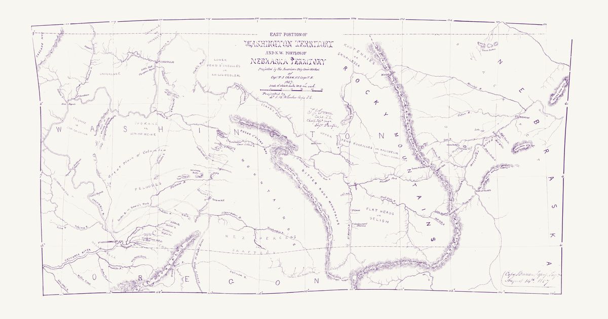
Captain T. J. Cram’s map of the eastern part of Washington Territory and the north-western part of Nebraska Territory, “projected by the American Poly Conic Method” by Lt. J. B. Wheeler of the Topographical Engineers; this is the Bureau of Topographical Engineers’ copy, dated 14 August 1857. It is a nations map: each nation is lettered in red over its country, most with a second name — Okinakane; Colville or Shoveltý; Pisquose or Sin-ka-oo-ish; Spokane or Sin-hu-me-ne; Pelouses; Os-hawm-wap-pam; Walla Walla; Cayouses; Nez Perces or Saaptedy; Kootenaies or Skna-lessa; Lower Pend d’Oreilles or Ka-lis-pedlem; Upper Pend d’Oreilles or Kalispelm or Skalt-kooms-sky; Flat Heads or Selish; and the Blackfeet east of the Rocky Mountains — and broad red lines bound their lands. In our words: the Plateau nations’ lands of the 1855 treaties — the Okanagan, Colville, Wenatchi, Spokane, Palouse, Pshwanwapam (Upper Yakama), Walla Walla, Cayuse, Nez Perce (Nimiipuu), Kootenai (Ktunaxa), Kalispel, Pend d’Oreille, Bitterroot Salish and Blackfeet (Niitsitapi). “Treaty Ground, Mill Cr. in 1855” marks the Walla Walla council. Fine red dotted lines with their camps marked are the routes of the reconnaissances the map was drawn from; one of them, from the forks of the Clearwater up the South Fork and east over the Bitter Root Mountains to the forks of the St. Mary’s (Bitterroot) River, is lettered “Southern Nez Percés Trail”. Large red letters A, B and C on the Columbia plain are not explained on the sheet.

Source: Wikimedia Commons · Rights: public domain

Open in the map

What the 1857 map shows

Lieutenant G. K. Warren compiled the War Department’s master map of the West from every exploration to date. Each nation’s country is named and tinted, with villages, forts, and the exploration and emigrant routes — most of them following trails travelled for centuries. Use the scan layer: the color tints carry the meaning.

Reading the overlay

At 1:3,000,000 the territory boundaries are Warren’s synthesis, not surveyed lines — read them as whose country, accurate to a few tens of kilometres.

Talk about Oregon

Discussion board for OR

Start a thread All discussions

Know Oregon? Join free to add field notes, fix where a place sits on the map, and help find more maps.Join free

Sources from readers

Know a county history, a survey record or an article that bears on this? Add a source — it’s credited to you.

Advertisement