Arizona: Native trails and villages
The Navajo, Apache, Pima and Papago countries, from Warren's 1857 War Department map of the West.
Open full-screen map
Historic maps for Arizona
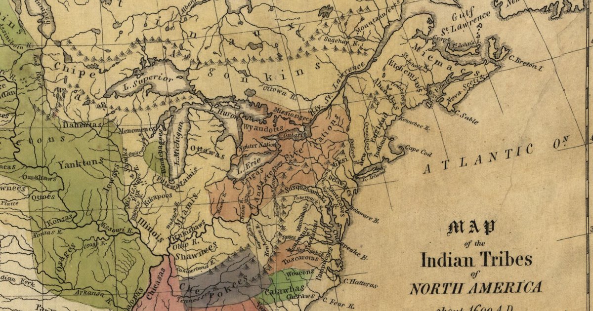
Hon. Albert Gallatin; published by the American Antiquarian Society, Pendleton's Lithography, 1836 · about 100 km accuracy
Albert Gallatin's founding map of American ethnology, published by the American Antiquarian Society with his Synopsis of the Indian Tribes: the homelands of the continent's nations tinted by language family — Algonkin-Lenape, Iroquois, Cherokee, Muskogee, Choctaw-Chickasaw, Sioux, Blackfeet, Pawnee, Athapasca, Eskimaux — as of about 1600 along the Atlantic and about 1800 westward. A continental baseline: every state shows its nations here.
Source: Library of Congress, Geography and Map Division · Rights: public domain
Open in the map
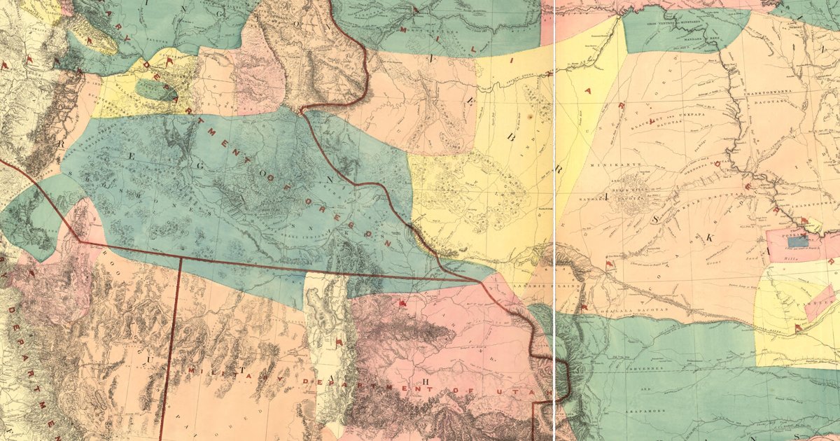
Lieut. G. K. Warren, Topographical Engineers, U.S. War Department, 1857 · about 50 km accuracy
Lieutenant G. K. Warren's master map of the West, compiled in the Office of Pacific Railroad Surveys from every reliable exploration to date: the named country of each nation — Dacotas, Sheyennes, Comanches, Shoshonees, Utahs, Navajoes, Apaches, Blackfeet, Crows, Nez Perces, Pawnees and many more — with villages, forts, and the explorers' and emigrant routes that followed Native trails.
Source: Library of Congress, Geography and Map Division · Rights: public domain
Open in the map
What the 1857 map shows
Lieutenant G. K. Warren compiled the War Department’s master map of the West from every exploration to date. Each nation’s country is named and tinted, with villages, forts, and the exploration and emigrant routes — most of them following trails travelled for centuries. Use the scan layer: the color tints carry the meaning.
Reading the overlay
At 1:3,000,000 the territory boundaries are Warren’s synthesis, not surveyed lines — read them as whose country, accurate to a few tens of kilometres.