Florida: Native trails and villages
The trails of north Florida — the crossing at Cow Ford (Jacksonville), Picolata on the St. Johns, and the mission road west to Tallahassee — from Myer's 1928 BAE map.
Open full-screen map
Historic maps for Florida
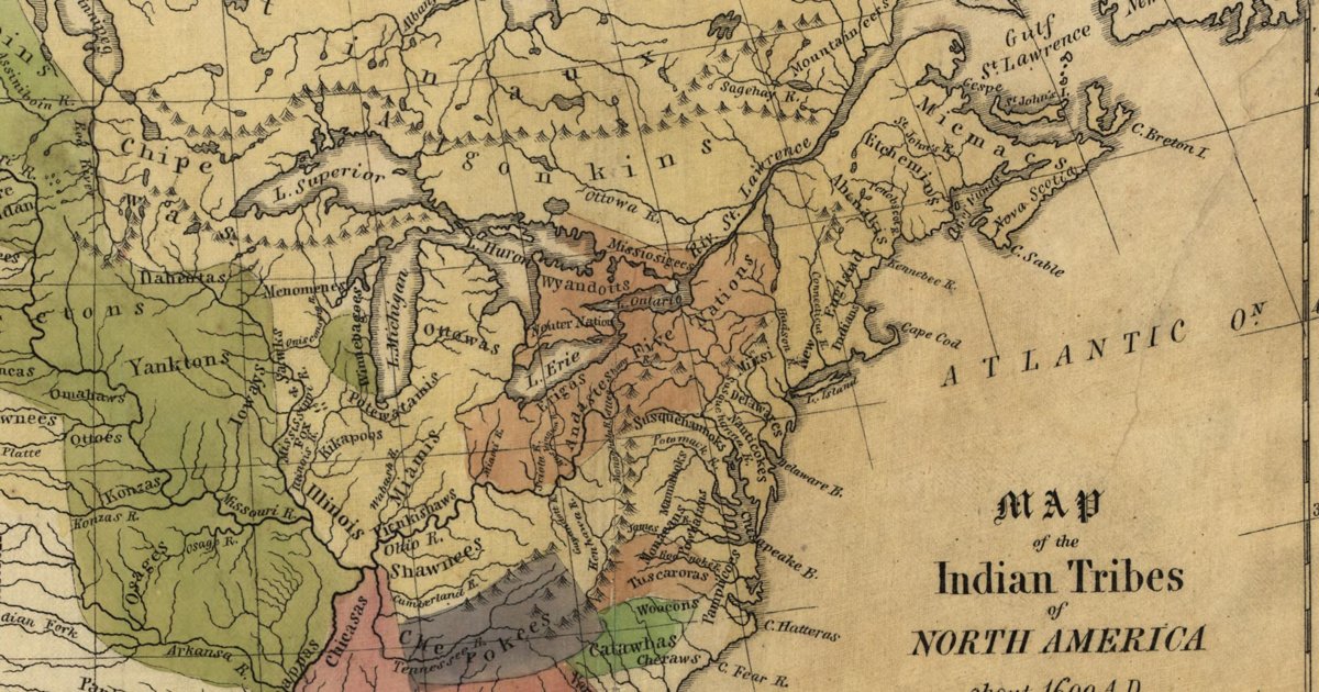
Hon. Albert Gallatin; published by the American Antiquarian Society, Pendleton's Lithography, 1836 · about 100 km accuracy
Albert Gallatin's founding map of American ethnology, published by the American Antiquarian Society with his Synopsis of the Indian Tribes: the homelands of the continent's nations tinted by language family — Algonkin-Lenape, Iroquois, Cherokee, Muskogee, Choctaw-Chickasaw, Sioux, Blackfeet, Pawnee, Athapasca, Eskimaux — as of about 1600 along the Atlantic and about 1800 westward. A continental baseline: every state shows its nations here.
Source: Library of Congress, Geography and Map Division · Rights: public domain
Open in the map
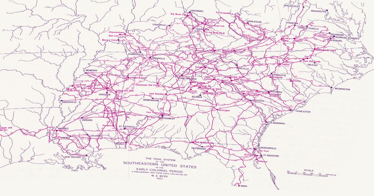
William Edward Myer, 1928 · about 10 km accuracy
William E. Myer's preliminary map of the trail network of the colonial-era Southeast, compiled for the Bureau of American Ethnology from early maps, land records and field work: over 125 numbered trails, historic towns and sites from the Ohio River to the Gulf and from the Mississippi to the Atlantic. Georeferenced to thirty modern city locations.
Source: 42nd Annual Report of the Bureau of American Ethnology (Smithsonian Institution, GPO); scan via Yale Beinecke Library / Wikimedia Commons · Rights: public domain
Open in the map
What the 1928 map shows
William E. Myer compiled the Bureau of American Ethnology’s trail map of the colonial-era Southeast from early maps, land grants and field work — over 125 numbered trails. The trails of north Florida — the crossing at Cow Ford (Jacksonville), Picolata on the St. Johns, and the mission road west to Tallahassee — from Myer’s 1928 BAE map.
Reading the overlay
At the plate’s small scale a drawn trail is a corridor several kilometres wide: read it as which valley and which gap, not which ridge. Switch to the scan layer to read Myer’s own lettering and trail numbers.
,_plate_15.jpg)