Tennessee: Native trails and villages
Myer's 1928 BAE map is densest in Tennessee, his home ground: the Great Indian Warpath along the Valley of East Tennessee, the Cisca and St. Augustine trail, the Chickasaw trails of West Tennessee and the towns of the Overhill Cherokee.
Open full-screen map
Historic maps for Tennessee
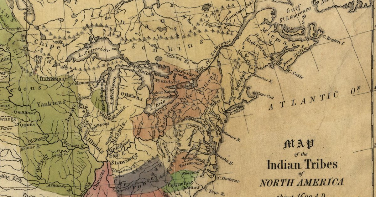
Hon. Albert Gallatin; published by the American Antiquarian Society, Pendleton's Lithography, 1836 · about 100 km accuracy
Albert Gallatin's founding map of American ethnology, published by the American Antiquarian Society with his Synopsis of the Indian Tribes: the homelands of the continent's nations tinted by language family — Algonkin-Lenape, Iroquois, Cherokee, Muskogee, Choctaw-Chickasaw, Sioux, Blackfeet, Pawnee, Athapasca, Eskimaux — as of about 1600 along the Atlantic and about 1800 westward. A continental baseline: every state shows its nations here.
Source: Library of Congress, Geography and Map Division · Rights: public domain
Open in the map
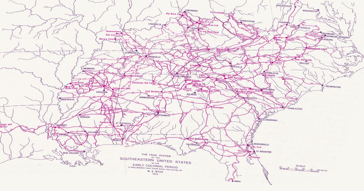
William Edward Myer, 1928 · about 10 km accuracy
William E. Myer's preliminary map of the trail network of the colonial-era Southeast, compiled for the Bureau of American Ethnology from early maps, land records and field work: over 125 numbered trails, historic towns and sites from the Ohio River to the Gulf and from the Mississippi to the Atlantic. Georeferenced to thirty modern city locations.
Source: 42nd Annual Report of the Bureau of American Ethnology (Smithsonian Institution, GPO); scan via Yale Beinecke Library / Wikimedia Commons · Rights: public domain
Open in the map
What the 1928 map shows
William E. Myer compiled the Bureau of American Ethnology’s trail map of the colonial-era Southeast from early maps, land grants and field work — over 125 numbered trails. Myer’s 1928 BAE map is densest in Tennessee, his home ground: the Great Indian Warpath along the Valley of East Tennessee, the Cisca and St. Augustine trail, the Chickasaw trails of West Tennessee and the towns of the Overhill Cherokee.
Reading the overlay
At the plate’s small scale a drawn trail is a corridor several kilometres wide: read it as which valley and which gap, not which ridge. Switch to the scan layer to read Myer’s own lettering and trail numbers.
,_plate_15.jpg)