The Hawaiian Government Survey's maps of Hawaiʻi Island (1886) and Kauaʻi (1903), the Geological Survey's 1913–30 maps of the whole island, and its 1920s maps of Lānaʻi and Kahoʻolawe: the island trails, the ala loa, and the ahupuaʻa and old place names of every coast.
Hawaii Territory Survey (Donn and Wall), 1903 · about 3 km accuracy
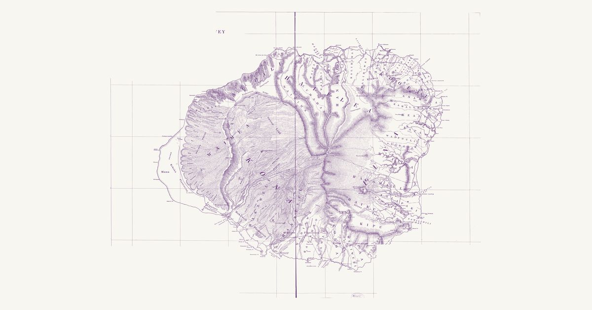
The Hawaii Territory Survey’s 1903 map of Kauaʻi: the island’s ahupuaʻa and moku, the trails over the mountains and along the Nā Pali, the old Hawaiian place names of the valleys and headlands, and the plantations, landings and roads of the time.
U.S. Geological Survey, 1929 · about 3 km accuracy
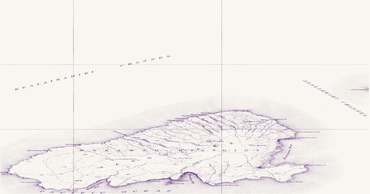
The Geological Survey’s 1929 topographic map of Kahoʻolawe: the trails across the island between its landings and ranch sites, the Hawaiian place names of its bays and headlands, and the island as it was before its use as a bombing range.
U.S. Geological Survey, 1924 · about 3 km accuracy
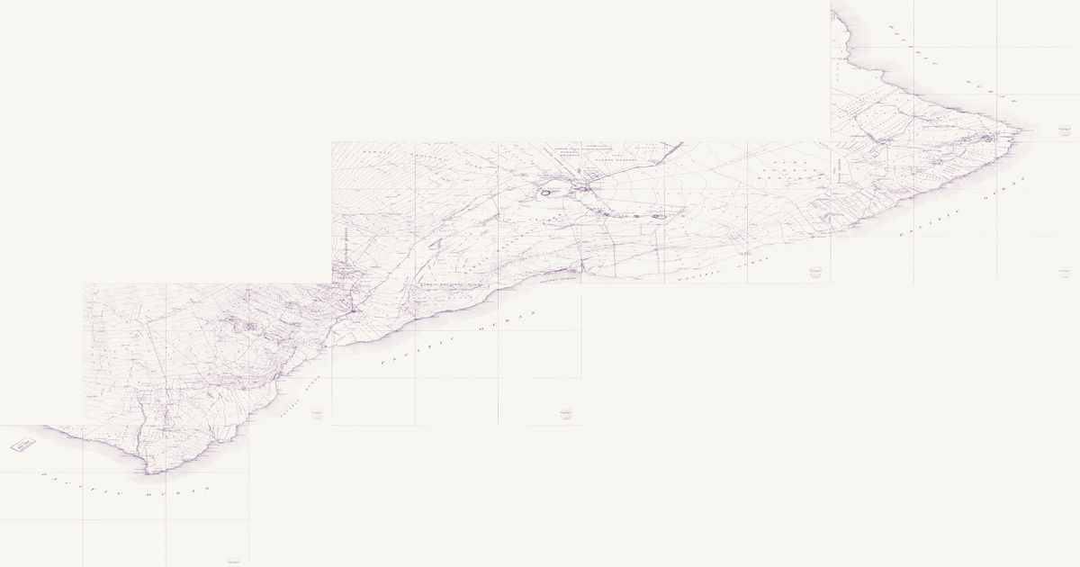
The Geological Survey’s first topographic maps of Kaʻū and Puna, joined into one sheet: the trails — many of them the old ala hele and the coastal ala loa — between the villages, landings, water holes and shelters, across the lava fields and through the Kaʻū Desert, with the land divisions and Hawaiian place names of the 1920s.
U.S. Geological Survey, 1928 · about 3 km accuracy
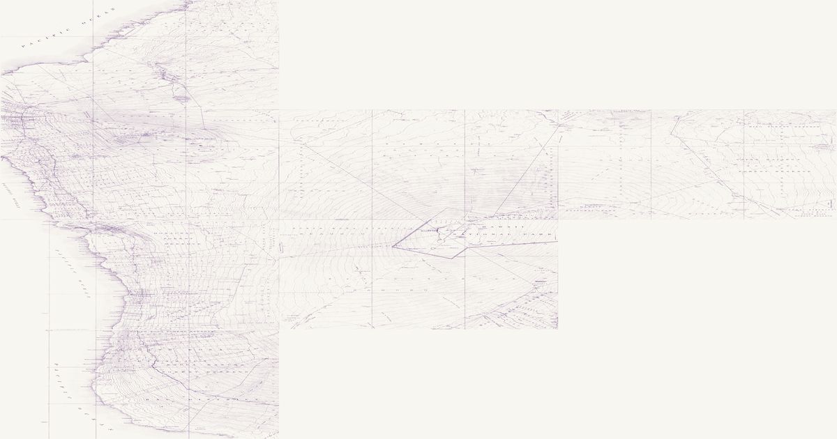
The Geological Survey’s first topographic maps of the Kona coast, the saddle and the slopes of Mauna Loa, Hualālai and Mauna Kea, joined into one sheet: the coastal ala loa and the mauka trails between Kona, the saddle, Humuʻula and the summit of Mauna Loa, with the ahupuaʻa and Hawaiian place names of the 1920s.
U.S. Geological Survey, 1923 · about 3 km accuracy
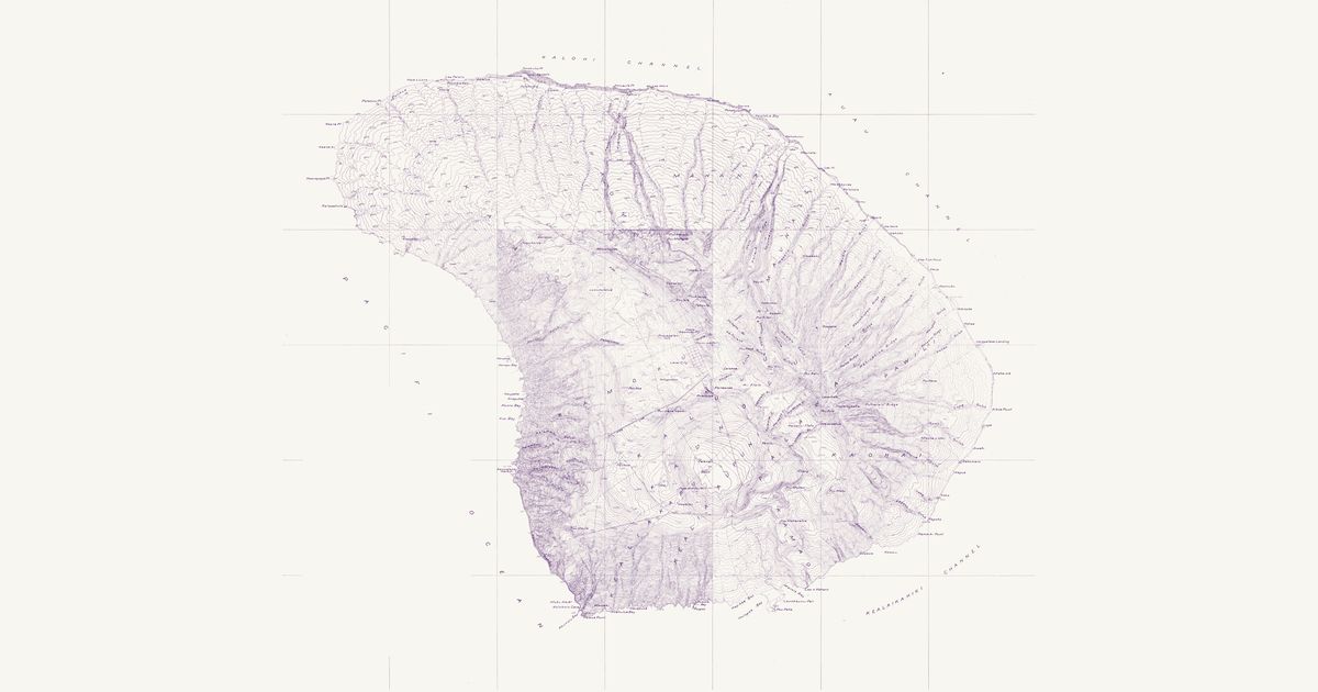
The Geological Survey’s 1923 topographic map of Lānaʻi at two inches to the mile: the trails between the island’s old villages and landings — Kaunolū, Maunalei, Keōmuku and the windward coast — over the uplands of Pālāwai, with the ahupuaʻa and Hawaiian place names of the island.
U.S. Geological Survey, 1917 · about 3 km accuracy
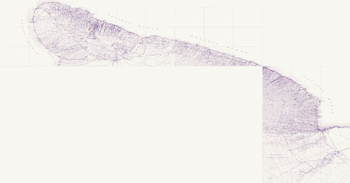
The Geological Survey’s first topographic maps of the windward and northern coasts of Hawaiʻi Island, joined into one sheet: the trails into the valleys of Waipiʻo, Waimanu and Pololū and along the Kohala and Hāmākua coasts, with the land divisions and Hawaiian place names of the 1910s.
W. A. Wall, Hawaiian Government Survey, 1886 · about 4 km accuracy
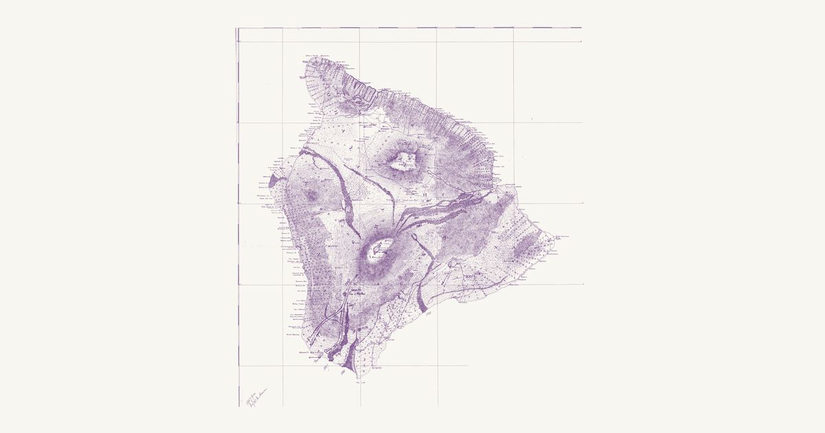
The Hawaiian Government Survey’s 1886 map of Hawaiʻi Island: the moku and ahupuaʻa, the island-wide trails — the coastal ala loa and the mountain trails between Kona, Kaʻū, Hilo and Waimea — the old Hawaiian place names along every coast, and the lava flows of 1801–1881.
The Hawaiian Government Survey, under Surveyor-General W. D. Alexander, mapped the kingdom’s islands from a primary triangulation begun in the 1870s. W. A. Wall’s 1886 map of Hawaiʻi Island draws the trails that crossed and circled the island — the coastal ala loa and the mountain trails linking Kona, Kaʻū, Hilo and Waimea — with the moku and ahupuaʻa boundaries, the lava flows of 1801 to 1881, and the Hawaiian names of the headlands, bays and villages along every coast. The Territory’s 1903 map of Kauaʻi, compiled by John M. Donn from Walter E. Wall’s surveys, does the same for Kauaʻi, with the trails over the mountains and along the Nā Pali.
The Geological Survey’s first topographic maps of the island, joined here into three sheets — Kohala, Hāmākua and Hilo (1913–17), Kaʻū and Puna (1922–24), and Kona, Mauna Loa and Humuʻula (1927–30) — show the trails in far more detail: into the valleys of Waipiʻo, Waimanu and Pololū, along the windward and Kona coasts, over the saddle to the summit of Mauna Loa, and across the lava fields and the Kaʻū Desert. Many follow the old ala hele. The Survey’s maps of Lānaʻi (1923, at two inches to the mile) and Kahoʻolawe (1929) show those islands’ trails, landings and place names — Kahoʻolawe as it was before its use as a bombing range.
Reading the overlays
Both maps are fitted to their own printed graticules, and both come out within a few kilometres (about 4 km for Hawaiʻi Island, 3 km for Kauaʻi). The 1886 Hawaiʻi map is a preliminary edition: its coastline is drawn up to a few kilometres off in places (Ka Lae, Cape Kumukahi), so match places by name as well as by shape. Many trails shown here are now roads, ranch tracks, or lost under later lava; others are cared for as part of the Ala Kahakai National Historic Trail.
Know Hawaii? Join free to add field notes, fix where a place sits on the map, and help find more maps.Join free
Sources from readers
Know a county history, a survey record or an article that bears on this? Add a source — it’s credited to you.
Advertisement
Your privacy choices. Ads keep this site free; Google serves them. You can turn off personalized ads: you'll still see ads, but not ones chosen from your activity on other sites. In the EU, UK and Switzerland, Google's own consent message asks you instead. Analytics never use cookies or identify you.